What is Geomatics
Geomatics is the science of acquiring, storing, managing or manipulating spatial or geographic data. Advanced digital technologies are mouch more accurate and helpful the older forms of looking at the world such as aerial photography or 2D maps.
For Example, through the use of geomatics tools such as remote sensing and 3D software, two dimensional images can be manipulated into a three-dimensional virtual tours to provide a completly realistic view of a geographic location that can bring light to problem areas or challenges.
Geomatics - A Clear Perspective
Visualizing the big picture is a critical component of any successful project. Though Geomatics, you will gain a clear perspective into seeing the many layers of a situation and how they interact with one another.
Membertou Geomatics Solutions provides the visual tools you need to gain that clear perspective. Our specialized services and customised solutions combine many complex pieces of information such as geographic, demographic and other data into logical, cohesive, visual representations.
Contact Membertou Geomatics Solutions to find out how we can provide the information you need to gain a clearer perspective
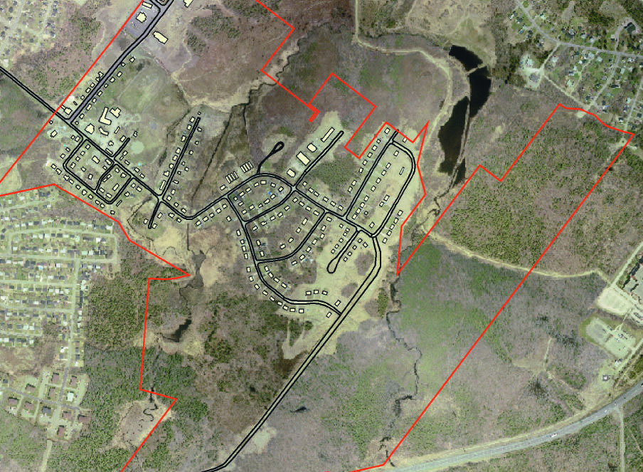
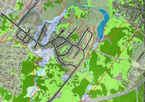
Our customized solutions provide valuable information at a glance, through separate layers or combined for a complete view.