REMOTE SENSING
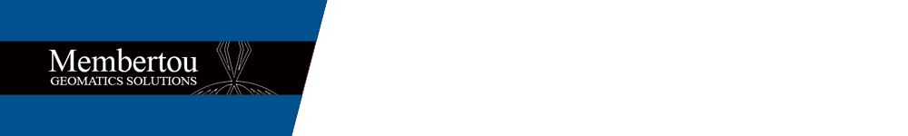
One of our key data capturing techniques is remote sensing, which combines elements of imagery, photography and numerical data captured from low to high altitude and space sensors. Common methods of collecting this information are aerial photographs, satellite imagery, and RADAR/LIDAR.
Read more
Data from remote sensing has benefi�ts over traditional visual tools such as provincial or municipal maps. Where most existing maps are dictated by old information, remote sensing provides the ability to use current information that is customized to the client project. The maps and other visual aids created from remote sensing are highly accurate, detailed and scalable. With this type of information, remote sensing provides a view of the area in its current situation, with images that are up to date and relevant to your project.
There are many examples of areas where remote sensing can provide e�cient imaging solutions, including:
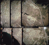
• Digital terrain models
• Spot elevations and hillshade terrain mapping
• Natural resource and feature inventories
• Land use and thematical maps
• Volumetric and area calculations
• Environmental monitoring and management
Remote sensing also allows us to map out whole communities in 3D, transforming 2D images, pixel by pixel, into 3D real-world coordinate system. The result is a clear view of our environment, which may then be used for further imaging, such as 3D visualizations or virtual tours to help you develop a realistic and informed sense of the situation – and the action plan to move ahead.
View less